Future Pope Bend Construction
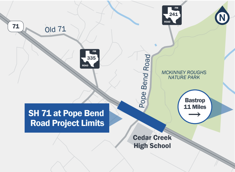
The proposed construction at Hwy 71 and Pope Bend Rd is part of the broader SH 71 East Corridor Improvement Project. Some Old 71ers I've spoken to are worried the proposed plan removes the traffic light at Pope Bend without extending the frontage road to cover Old 71–making access to the highway more difficult and dangerous.
Here is the short fact sheet that explains the project and why the improvements are needed. Key points from the project site (and our concerns about them):
- A new overpass bridge on SH 71 over the existing signalized intersection at Pope Bend Road.
- However, this removes the red light which creates a break in SH 71 traffic
- New one-way frontage roads within the project limits.
- Old 71 is on the schematic, but not within the project limits? Although Applewood Dr, less than 700 ft away, is?
- Improved and expanded bicycle and pedestrian accommodations.
- A welcomed improvement, but not helpful for daily car commuters–the overwhelming majority of us
Removing the Pope Bend red light could mean fewer breaks in Hwy 71's traffic during peek hours. With the turn around moved west, drivers will need to: accelerate, cross two lanes, then come to a stop, in relatively short time.
Here is a link to the PDF schematic of the intersection changes: https://ftp.txdot.gov/pub/txdot/get-involved/aus/sh-71-east-tucker/052218-schematic-pope-bend.pdf
For those of us not experts at reading civil engineer schematics, here is a crude MS Paint interpretation (accuracy based on my understanding, errors are not unintentional).
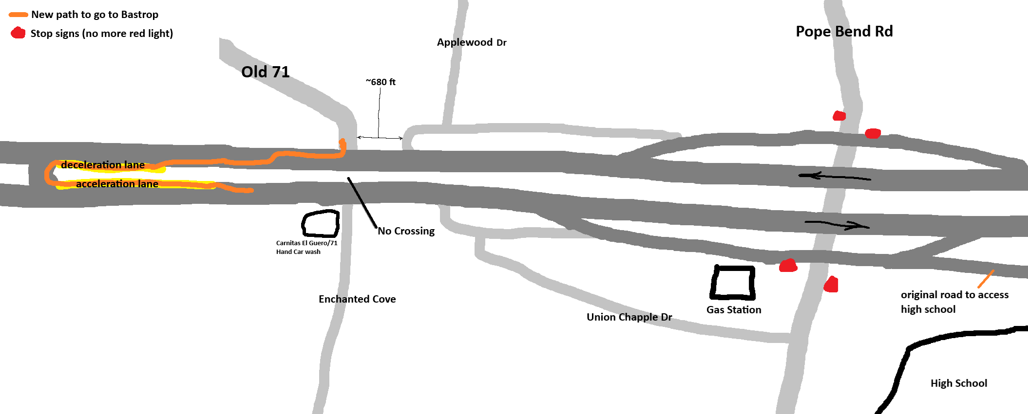
The good news is these plans are not set in stone. Printed across the bottom of the schematic is: "PRELIMINARY - SUBJECT TO CHANGE". If the feeder could be extended and made two-way, it could allow the growing number of drivers from Old 71 easy access to Pope Bend Rd and SH 71. With 905 parcels* between the four major neighborhoods of the Old 71 area, that's a lot of people needing to get out onto the highway.
| Subdivision | Parcels |
|---|---|
| Double Eagle Ranch Section 1 | 73 |
| Double Eagle Ranch Section 2 | 113 |
| Double Eagle Ranch Section 3, Phase A | 41 |
| Double Eagle Section 3, Phase B | 63 |
| Double Eagle Ranch Section 4 | 89 |
| Double Eagle Ranch Section 5A (River Bend) | 112 |
| Double Eagle Ranch Section 5B (River Bend) | 185 |
| River Crossing Section 1 | 138 |
| River Crossing Section Two | 30 |
| The Forest At Colorado Crossing Section 1 | 61 |
| Total | 905 |
I encourage anyone with questions, concerns, or feedback to reach out to the Texas Department of Transportation, through their contact page. We can also reach out to Representative Stan Gerdes. If anyone learns anything interesting please share it with us through the email on our about page.
* Parcels does not mean number of houses with drivers, I used this metric because it was easy to get from Bastrop CAD. It's a simple indicator of how much this area has grown. Hopefully, as I get better at this I'll learn ways to derive how many houses there are without counting them on Google Maps.
A fun fact I learned while working on this, a parcel is any piece of land with legal boundaries. Property is the parcel and the stuff on it.